Tool Test: Story Maps

Sleeter, S. Michael. “Southwest History Project.” StoryMap JS. https://storymap.knightlab.com/edit/?id=southwest-history-project.

            I worked with Storymap JS for this tool test.  The site allows you to take pictures and mark where they are from on a map.  It has a space of a caption and you can cite the source of the picture too.  There is a headline that you can write to name the picture or place, depending on how you are setting up the story.  Below the headline box is a place for text.  This box can be utilized in several different ways.  The most obvious one is to tell that part of the story for that picture.  It can also be used to simply describe the picture or the place that is being shown.  Finally it can be used to give information about the history of the area featured in the picture.   This is a great way to organize pictures or to use pictures to tell a story that is connected to locations.  The site is easy to use and the maps are simple to put together.

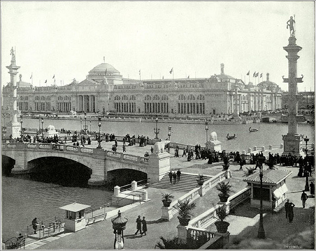
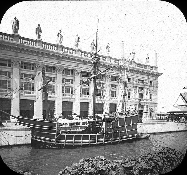
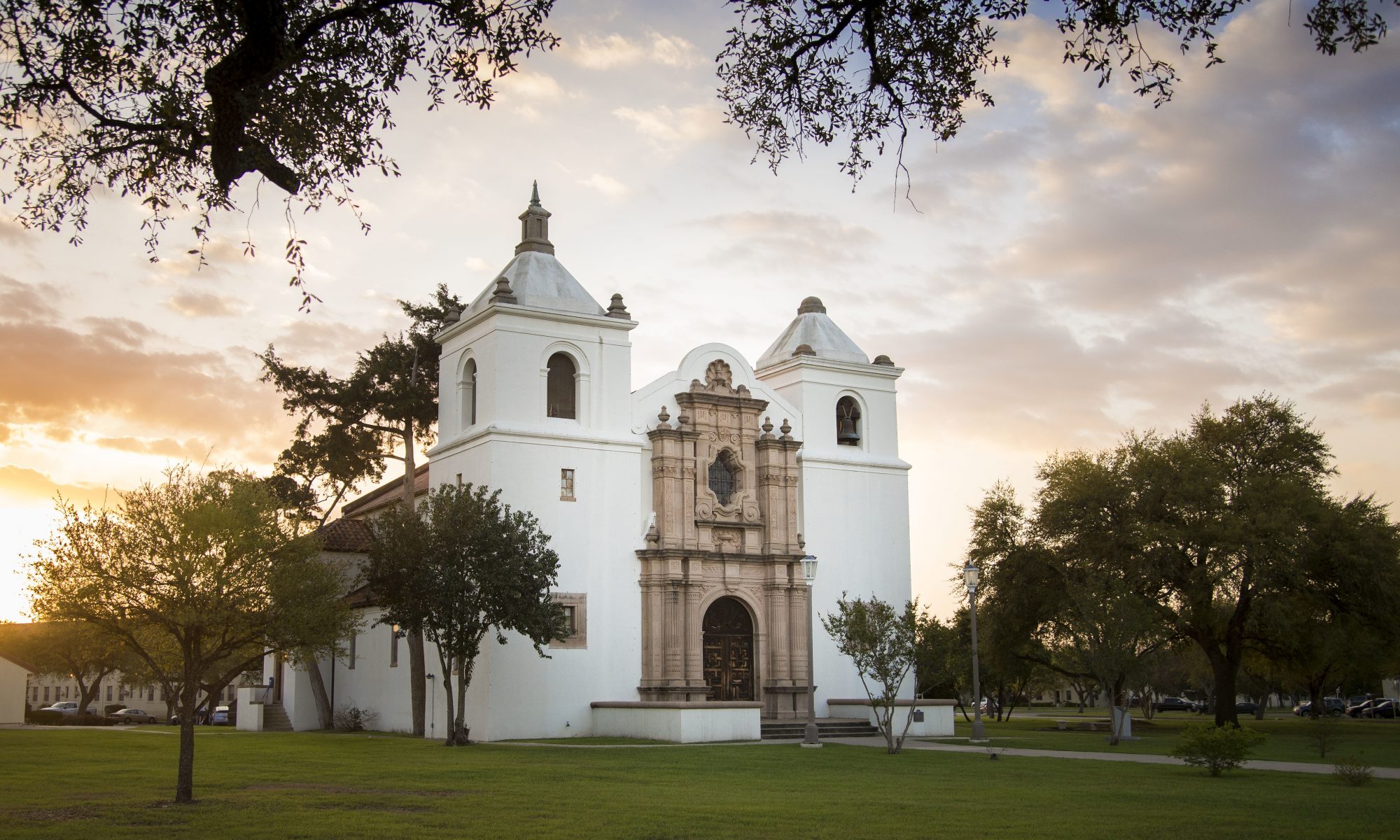
For this test I used pictures that I took in conjunction with the Southwest history project.  I wanted some primary source material that I controlled the rights too just to make things easier.  I laid out the pictures into a kind of tour of the area that people could use to guide themselves to important sites in the district.  I added a little bit of text as part of the trial, I will go back in fill in the historical research that I have done on these places to bring the tour up to professional quality.  Also I could have united the places by telling a story.  Not just having people travel through the space of the district, but traveling through the time as well.  That will be something I consider when I revise this project. 

This program is a real good tool for both professional digital historians and casual ones.  Students learning about history can also put this site to good use as a way to present projects they have worked on.  The photos were easy to upload, but they had to be the right size.  I had to crop all the photos I took because of the size limits.  The other issue I had was that you could only have one photo per slide.  This is annoying if you wanted to display multiple photos of a place.  You would have to set up multiple markers at one site.

I look forward to revising my test project and using this site in future projects to help people understand the history of space.  I am a strong believer in that you need to understand geography to have a full grasp of history.  This is one more tool to help people accomplish that goal.    

Digital Review: Bdote Memory Map

“Mitakuyepi! Welcome!” Bdote Memory Map. http://bdotememorymap.org/.

The Bdote Memory Map started out as a local history project on a wall of the Ancient Traders Gallery in Minneapolis.  The gallery is a community center for the Dakota people in the area.  The visitors who toured the gallery participated in the collection of the community history by writing their memories of Dakota sites on the wall.  The wall featured a map of the Minneapolis-St. Paul area and was marked with important Dakota sites.  It displayed the sites with their Dakota names and allowed people to connect with those places.  Eventually the memories found a new home as they became digitized and turned into the bdote memory map.  The website is a continuation of the map on the gallery wall, plus the addition of educational tools and a telling of Dakota history. 

The website presents itself extremely well.  It is eye-catching and reflects the Dakota culture in many facets.  The main page has a menu that allows visitors to navigate the site.  A tab at the bottom of the page provides users with some background information about the Dakota.  It did not take me long to learn why this site was called the “bdote” memory map.  Clicking on the bottom of the circle takes the user to a video where a video shows a greeting in the Dakota tradition.  A click to the right side of the circle and the user finds a video that explains the Dakota place in the world as “Urban Tribesmen.”  The short video explains how the city is their home even after losing the land their ancestors lived on for hundreds of years.   Clicking on the top of the circle takes the visitor to the memory map.  It contains places around the Minneapolis-St. Paul area that are important to the Dakota tribe.  When the user clicks on the site, they choose a list of videos about specific spots.  Many of the videos are oral histories by people who witnessed the history that unfolded at those places.  The left side of the circle provides a link to a brief history of the Dakota people in the area.  It also explains the importance of being connected to a place.  Tabs at the top of the page provide a Dakota glossary with words read by the Dakota people themselves.  There are also lesson plans for teachers to help them teach about the Dakota tribe.

I found this website to be a great resource, it contains great primary sources and the information is easy to access.   The first thing that I noticed was that this website encompasses everything that public history is.   It is a community history, written by the community, for the education of the community and the public in general.  It provides insight into the history of the Dakota people in the twin cities area of Minnesota.  It allows community members to participate by adding their voices to the record and it allows young Dakotas to learn their history and traditions from their tribe members.  This well-designed site is very user-friendly.  It is a great place to learn more about the Dakota people for anyone who is interested in learning about them.  This site would be especially useful to anyone doing research on the Dakota people.  The oral histories are especially valuable for the stories that they record about the people and their experiences. Go and see for yourself, if nothing more than to discover why it is called the bdote memory map.


6 Degrees of Francis Bacon: A Review

Warren, Christopher, Daniel Shore, Jessica Otis, Scott Weingart, and John Ladd. Six Degrees of Francis Bacon. Accessed February 23, 2019. http://www.sixdegreesoffrancisbacon.com.

The website Six Degrees of Francis Bacon an attempt to link the English philosopher and public official Francis Bacon to his contemporaries, who lived during the Elizabethan era. Bacon sits in the center of what is a visual who’s who of the period. Names range from important to the lesser-known. This site is a great starting point for research on the era, and it is a great example of what crowd sourcing can do as the public contributes data for the site. The visual connections could aid a researcher in noticing a relationship they may have missed. The public has the ability to add new people to the web and expand the connections of the people already there.

While Queen Elizabeth would seem to be the obvious choice for a project like this, Francis Bacon is an excellent choice. Not only is it a parody of the Six Degrees of Keven Bacon game, but Sir Bacon had many spheres of influence during his life. He was a philosopher, scientist, and he served as Queen Elizabeth’s Lord High Chancellor. This gives him contacts with many types of people during his life who operated in many different spheres.

The website is easy to use, and after interacting with it for a bit of time it becomes easier to understand. A tutorial takes you through all the site’s features in a few minutes for those who would like a systematic guide. The data is displayed as a three-dimensional web that can be manipulated by clicking and dragging . Sir Bacon sits in the middle and different strands connect him to various people of the time. Although the site bears his name, researchers can make any name the focus of a smaller web with just a click. Although the name does mention six degrees this is somewhat misleading as only two levels of connections are available. Another feature is the ability to view groups of people. For instance, the researcher can click on one of the metadata boxes at the bottom of the page and call up all the philosophers in the web. There are almost 75 categories to activate. When viewing a person’s web, the boxes at the bottom light up to signal that members of those professions are present. To meet the needs of researchers who require more information about the people in the web, a box to the left provides links to three different research sites where more information is available.

The audience for this website may vary greatly. The connection to six degrees of Keven Bacon may attract casual web surfers. They may not stay for long though because the site is limited for that use. Researchers of the Elizabethan Age of England will get the most out of this site. Being able to see connections or looking for new relationships is what this site does best. Causal history buffs might get something out of this site too. They would be the target audience if the connections ran deeper. It is feasible that a casual history buff could spend hours seeing who claims a connection to Francis Bacon and wind up exploring those connections for hours. Maybe they will expand the Bacon web in the future.

The website makes for an interesting research tool. Both researchers and casual users would be able to get something out of a visit to this site. The lack of depth is a bit disappointing. The two levels of connections are a limit to both research and fun, but again, maybe the future will allow for expansion into a site worthy of its name.

Digital Review: Nevada Test Site Oral History Project


Nevada Test Site: Oral History Project. Unlv. Southern Nevada: The Boomtown Years Mining. Accessed February 25, 2019. http://digital.library.unlv.edu/ntsohp/.

This website is a collection of stories about the nuclear testing that was done in the Nevada desert north of Las Vegas. Over 1000 nuclear detonations were initiated at the test site between its opening in 1951 and 1992 when the United States finally ended nuclear weapons testing. The website has collected 335 hours of recordings from many different people connected to the site both directly and indirectly. There are stories told by people who were in the military that were in charge of operations at the site.  Contributions from physicists, other scientists, and engineers who worked on developing and building the nuclear devices that were being tested and the experiments that recorded data about their effectiveness. There are even stories from people who tried promoting peace by protesting the activities taking place at the test site. Native Americans lend their voices also to tell the story of how the desert is a sacred place to their tribes. 

The home page is well organized and easy to navigate.  There are links below the header that will take researchers to a timeline, the collection of stories, or maps of the relevant areas.  The timeline covers the entire Manhattan Project and it designates what events took place at the Nevada Test Site.  Clicking on an event on the timeline will take the researcher to interviews that talk about that time.  This is a very convenient search feature.  Going to the link Community of Voices gives the researcher access to all the interviews that the site has collected.  There is a search feature but no explanation on the metadata.  The search can be done by person or key word or phrase. 

The interviews are all recorded video.  The people telling their stories can be seen talking and giving their recount of events.  There are a wide range of perspectives to choose from.  The military people and scientists who were working inside the test site give researchers a feel for their work and conditions, while protesters and peace activists tell the tales of how they tried to stop the experiments that were designed to build bigger and better weapons.  The Natives American recount how the land is sacred to them and how this military base has affected their people by cutting them off from the land of their ancestors.  The stories go beyond the Manhattan project and the Cold War.  They talk about how lives were changed by the work done at the test site. 

This is a great website to use for research on the Cold War.  The ability to search by event, date, or key word is extremely useful.  This would be a great start to uncover primary accounts of the development of the American nuclear program.  It is also very helpful if doing Native American studies or research on the peace movement that went on during the Cold War.  The stories are easy to access and they are well documented.  This would be a useful site to even the casual user who just wanted to learn more about the era. 

Review of Archives of Lesbian Oral Testimony

The oral history project I chose to explore for my review is a collection of stories about lives of women who are lesbians. These women experienced different trials and tribulations as they grew up in different time periods. They relate what their daily lives were like and the things they experienced growing up in often conservative communities.  I picked this one because I thought it would be interesting to hear accounts of lives that do not get regular attention in the mainstream history books.

The archive is housed at Simon Fraser University in Canada. It is maintained by their library’s special collections archive and is funded by grants from the Canadian Government. They have recently begun exploring digital media options for making their archive more participatory. The website has a huge collection of stories collected over many years from many different decades. This gives interested people a chance to hear about what life was life for these women in the 1930s and 40s and not just the post 70s era. Some of the stories were in an audio only format and some were recorded as audio and video. Both formats were of great quality and I had no trouble understanding the story teller in either format. The archive is well organized and has well documented metadata to aid research. There are labels for topics, places, and time periods. The researcher can click on a decade mentioned in the talk, or they could click on a place that is talked about in that segment. Different topics are also tagged in the metadata. There are labels for things like work, Sex and relationships, coming out, first kiss, and discrimination just to name a few.

I looked over several different files before I found one that I listened to at length. The different stories that I randomly clicked on were all over an hour and they all had multiple parts on file. Some of the recordings ran for a little more than an hour while others had over five hours of recordings archived. The stories were very detailed. The speakers went over what their lives were live from very young ages. I listened to a lady’s account about how she grew up in Utah in the 1940s. She shared details about how she was different from all the other kids she played with. Little things, like how she wanted an erector set for Christmas but her parents bought her dolls instead and how when playing house she didn’t mother her dolls but instead pretended to be the leader of a pioneer family fighting the wilderness for survival. She shared some very personal details about the girl she had her first sexual experimentation with as she was growing up. Her account of her marriage and the loneliness of being a housewife who did not relate well with the other wives in the neighborhood. The other stories I briefly previewed followed this pattern.

The stories I listened to were not heavily edited, although it could have used some touching up of some background noise. There was no conversation with the interviewer, it was just the speaker recounting her story. The only prompting from the interviewer was an occasional reminder after a break. It worked rather well considering the lack of dressing up. The stories were interesting and it was a great look into history from a different perspective.

The Podcast Project

 Click here for the Podcast.

This was an amazing assignment. Mario and Kristine were great to work with. We were able to come up with a idea that we felt comfortable with and that we could execute in a decent manner. We chose a round table discussion style format because we did not have a lot of technical knowledge or experience in making a podcast and did not want to be overwhelmed in the editing process. The topic we agreed on was to look at historical walls and compare them to the current Presidential administration’s national security policy. We shared research duties and wrote our own segments. Kristine took on the role of host while Mario and myself were the historical experts. We each presented our segments and then answered questions put forth by Kristine. I took on the role of editor which was the most challenging part of the project, at least from my point of view.

I learned many things from this project. The main thing being how to listen to the sound of my own voice. I have always hated the way I sound on tape and it was a challenge to listen to me talk on the recording. I got real comfortable with the software real fast. I stitched together the 4 segments we recorded. I also edited out all the umms, awkward pauses, and random noises as best as I could. I am rather impressed at how easy the editing was. I feel that I could handle a bigger project and tougher challenge like moving chunks of audio around in the recording to make a better story.\

The next time I would work a little bit more on the recording volume. I think that was a weak point. The other thing I would do would be to script the questions out a little better. I thought the discussion time would carry on longer but we could not keep it going and I think we fell a little short in time. Overall I think we made a great effort and we really didn’t have any problems that caused drama or tension in the group. I look forward to doing this again.

Digital Review: Geography of the Post

Blevins, Cameron, Jocelyn Hickcox, Jason Heppler, and Tara Balakrishnan. “Geography of the Post.” Cameron Blevins.  Feb 5th & 6th 2019

 “Geography of the Post” is an attempt to catalog every post office, both active and inactive that was constructed west of the 100th meridian between the years of 1846- 1902 in the United States.  The location of each post office that the site could verify is represented on the map by a colored dot. Researchers have two options for viewing the data. The first option uses four different colored dots to indicate the status of an office at a given location.  The designations tell the researcher if the post office was Established, Closed, Active Throughout, or Established and Closed.  The second option displays the post offices with dots showing how long they were active.  The darker the color of the dot, the longer it was in service.  Both views allow the user to adjust the period they are viewing but only for the aforementioned years.  The data variables can be set to any years in that range.  The creators note they were unable to include every single post office in this region due to gaps in the records, and that some of the post offices that are listed as newly opened were in fact renamed offices.  To aid researchers, they have included a running total of the percentage of post offices documented. 

The website uses data compiled by Richard Helbock in his work United States Post Offices vol. 1-8. The map that is used to display the data was created exclusively for this project.  Others might have chosen to use Google maps or a similar mapping application, but the creators opted for an application were they could keep complete control.  The display looks nice and anyone remotely familiar with the geography of the United States will easily recognize the shapes on the map.  However, the interface is clunky to use and just enough to annoy the user.  T is able to be moved around to focus on what the researcher is looking for, but it is a bit slow in its response to the movements of the mouse.  It also lacks a zoom feature, which prevents researchers from looking at things on a county or city level and thereby limiting the scope of research.  It only offers the region-sized map for viewing, and there are no geographic references besides the state boundaries.  There is no feature that gives the user a satellite view or allows for adding features like roads or rivers to the map.  This may require a researcher to have to cross reference other sources to verify locations of offices.

The audience for this website is going to be very limited.  Researchers who are doing projects focusing on the western United States are the main beneficiaries of this database.  The lack of a zoom feature would be a huge detriment to anyone doing a local history project at the county level or smaller.  On topics pertaining to the western states, this could be a very helpful website.  Using the data to track population movements or their rise and fall is rather easy to do, however the time limits are also constraining with that task.  A person with a casual interest in history is not going to get much out of this site.  The scope is too narrow and the features are underwhelming. 

The site does not make good use of the digital media.  It does compile a large amount of data into a usable format, but many features are lacking.  The slow interface also takes away from what should be a nice interactive experience.  The map itself is nice, but there is not much difference between that and a scanned piece of paper with the same dots on it.  This site falls short on what it could be.

The site was put together by Cameron Blevins, Jocelyn Hickcox, Jason Heppler, and Tara Balakrishnan.  They are associated with Stanford University. 

Overall, the site is underwhelming. It works well as a visual database, but the area it covers and the lack of geographic information potentially limit the types of research it would aid.  It is does have its purpose, but it is very niche.  For someone studying population movement of the American West at the end of the 18th century it would be a great tool, studying the postal coverage of El Paso, TX not so much.  Being able to zoom in closer would be a big improvement to the usability of the website.  Having more post offices on the map would also improve what the website can do.  Being able to see all the post offices to the Mississippi River or even further East would increase the research possibilities.   Marking the map with geographic features would help to improve accuracy of research being done also.


The Colombian Exposition of 1893: Killers Past and Present

1892 marked the 400th anniversary of Columbus’ landing in the Americas.  To mark the occasion the 1893 World’s Fair would be a celebration of that event.  The city of Chicago won the right to host the fair, beating out New York in a

Field Museum Flickr

very close vote.  Planners would put on an incredible display of human achievement on the shores of the biggest lake in the United States.  Officially it was called the World’s Colombian Exposition, its nickname was The White City.  The main focus of the exposition would be Columbus’ voyage, however, the plan would be to show off all sorts of exhibits from around the world.  Any country that wanted to participate would be given a display area to showcase their culture and achievements.  As with other World’s Fairs during this time, many new inventions would be seen by the public for the first time.  However, the legacy of the White City would not be the glimpse into the future it provided, but a legacy of death.

A Celebration Built on a Lie

By the 1880s, it was known that Columbus was not the first European to set foot in the Americas.  Researchers had uncovered evidence that Leif Ericsson had landed in Eastern Canada and made it as far south as modern

Brooklyn Museum Flickr

day Massachusetts.  Usually when new evidence is uncovered, the story is retold with the new facts, however in this case a powerful organization in the United States that would use its influence to keep Columbus in a place of historical prominence.  The Italian American Association used its influence to prevent Columbus from being demoted in the history books in the wake of these new revelations.  Their lobbying efforts were successful in keeping Columbus and his voyage the main focus of the 1893 World’s Fair.  Through their continued efforts Columbus would eventually receive a national holiday, one that is steeped in controversy.   Columbus changed the course of history, there is no doubt about that.  The problem with the Columbus story is the way it has been told in schools for many years.  In most textbooks Columbus gets the hero treatment.  The part of the story that gets left out is the millions of deaths he is responsible for.   The 1893 World Colombian Exposition did not mention his kidnapping of natives who were taken back to Spain and paraded through the streets like trophies.  Nor would visitors find a description of his treatment of the natives, who he and his men tortured to make them hunt for gold.  Details like how he spread disease among the natives would go untold in favor of tales of heroism, the wonders of discovery, and the opening up of this great land to the pioneers that would follow.  Not exactly the multi-voiced truth of history that one would hope to find today.

A Celebration of Mass Murder Hides a Serial Killer

Columbus’ blood soaked legacy was not the only horror attached to the 1893 Exposition.  Blocks from the fair a man opened a building and rented out rooms to people coming from out of town to visit the fair.  Many who rented a room there never checked out.  The building was owned by Dr. H. H. Holmes, and would be known as the Murder Castle.  History would record Holmes as America’s first serial killer, and most of his killing would be done in his Chicago complex that he custom-made for murder.  There were hidden gas vents for killing unsuspecting guests.  Chutes ran from rooms directly to a sub-basement where a kiln oven awaited bodies dumped down the chute,  incinerated with no one the wiser.  Due of the shoddy record keeping at the time, no one knows how many people died in that building.  Estimates are between 20 and 200, and there is no way to do any forensic research since the building was burnt down and any remaining evidence has been long destroyed.

The Best and the Worst of Humanity

It is ironic that the first serial killer in America operated in the shadow of a celebration of the first mass murder in the history of the Americas.  The World’s Colombian Exposition of 1893 is a reminder of how important multiple voices are when telling any history story.  By giving the Italian American Association too big a voice Columbus stands much taller in history than he probably should.  Today you can still visit grounds where the fair was held.  The main attraction is the Museum of Science and Industry, a museum dedicated to the technical achievements of man, much like the fair was.  While the fair did give us the Ferris Wheel, it also gave us an important lesson about how we remember history.


Additional Reading

The Chicago Sun Times “On its 125th birthday, what’s left from the 1893 World’s Columbian Exposition?” 4/29/2018

Larson, Erik  The Devil in the White City  Crown Publishers 2003


When Sears Used to Tower Over the Land

The competition among retail stores is brutal; it always has been.  Most people are familiar with the names JC Penny,  Montgomery  Ward, Woolworth’s, Marshall Fields, Macy’s, Neiman Marcus, and Sears.  Most of these stores have been operating for one hundred years or longer.  Some like Macy’s have given us iconic institutions like a Thanksgiving Day Parade, or like Sears who gave us the tallest building in the US at the time.  Rudolf the Red Nose Reindeer was

Now called Willis Tower this was originally the headquarters of Sears Dept Store. https://theskydeck.com/the-tower/

an advertising creation of Montgomery Ward who, more importantly, also started the catalog mail order service.  This business model would be copied by Sears and Roebuck.  Sears would become so successful at it they eventually rose to be the biggest retailer in the United States, a title they would hold from the 1920s until 1989.  Sears would actually play an important role in the history of the United States, and even as they currently struggle to stay in business they have made a lasting impression on the history of America.

The Internet is to Amazon as the Mail was to Sears

 The 1900s in the United States is going to see the end of what many call the Wild West period.  Millions of Americans were living in rural areas with very few of the amenities city dwellers enjoyed.  Sears would build his empire on the desire for quality goods otherwise not available to these people.  Modeling the idea that Ward pioneered, Sears would send catalogs out to rural homes offering thousands of goods they could order.  The items were shipped out and they could pick them up at the local train station.  Sears was instrumental in bringing city comforts to the rural population of America.  It evened the social divide between farmers and city folk.  People could buy almost anything from Sears.  Clothes, veterinary supplies, hubcaps, or even houses were all offered for sale among the pages.  While Sears helped make America by helping to break a social divide between rural and urban people in the United States, they would play another big role in breaking a different divide in America.

Through the Mail, No One Can See the Color of Your Skin

The first half of the twentieth century in America was marked by a deep racial divide.  This was the height of the Jim Crow era when African Americans were legally second class citizens.  They were not afforded the same rights as non-colored citizens.  Not only was the discrimination legal, but there was also the de-facto discrimination.  Businesses did not have to treat non-white customers with any form of equality.  African Americans were barred from sitting at lunch counters with whites or using the same doors as whites to enter buildings.  With zero legal protection, there were limited options for African Americans to have a positive shopping experience.  Enter the Sears catalog.  Ordering merchandise through the mail was a colorless experience.  The people filing the orders had no way of knowing if the customer was white, black, or brown.  This allowed African Americans to shop within the relative safety of their homes.  They had access to the same items that whites had access too.  They didn’t have to settle for poor treatment and inferior goods at the local store, they could get quality merchandise through the mail.  Everyone was equal in the processing room of Sear’s warehouse.

In Conclusion

Sears may not be around much longer.  Wards closed its last store about fifteen years ago, and Sears may be following suit.  When the last store closes its doors and turns off the lights for the last time a chapter of American history will close with it.  Sears might get a passing mention in a few history classes, but its contributions to the history of the United States will go mostly ignored.  These are the stories that we can not afford to lose, and that we should not allow being forgotten.

It’s Sundown, Are you Suppose to be here?

With the end of the Civil War in 1865 and the passing of the 13th, 14th, and 15th Amendments to the US Constitution, the United States became a very different place for the people who were held in slavery.  They were now legal citizens, could now be taught how to read, and were free to pursue their own destinies, however it was not going to be that easy.  During the ten years of the Reconstruction period the former slaves made great gains socially, economically, and politically.  With the protection of the Federal Government in the form of soldiers that were overseeing the Reconstruction process, African Americans were able to hold elected office, start businesses, and build schools.  However, with the end of Reconstruction and the withdraw of the soldiers from Southern states, the former slaves and their children lost the support of the Federal Government.  As power returned to the states and cities the defeated rebels would try everything they could to hold on the the old social order.  Poll taxes and literacy tests would suppress the African-American vote.  The Klu Klux Klan would rise to frighten and terrorize those who sought equality between the former slaves and their former masters.  One of the main ways to control the African American population was to pass city ordinances preventing the ownership of property by “colored people”.  These laws would lead to the creation of Sundown Towns.

A decent place to work, but you are not allowed to live there.

The term Sundown Town refers to a city or town that has legal ordinances that prevent minorities, usually African Americans, from owning property or renting a place to live within the city limits.  They could come in an work there, but they had to be out by sundown, hence the name.  The main goal of these laws was an attempt to keep the social order of the Antebellum South where separation of the races was a hard and fast rule.  If they could no longer keep their African slaves at least they could keep the social order as best they could.  The result being that the townsfolk would see the African Americans working at their menial jobs, but when they returned home they would not have to be bothered with the sight of them.  Their children would not attend school or play in the same parks together.

A legacy of hypocrisy

In his autobiography, Malcolm X noticed how upper class white people would come to Harlem on Friday nights to dance to the bands made up of African American musicians.  He would point out that these people enjoying the music would not give the musician the time of day if they crossed paths on the street.  That same hypocrisy can be seen in the workings of a sundown town.  The people will allow the African Americans to come in and cook their food and clean their houses, but have no interest in getting to actually know them on a personal level.  The result of this separation has created a climate where racism will continue unabated.  One of the best ways to combat racism is to get to know people who are different from you.  If you never get a chance to interact with different people then stereotypes become more believable.  The lasting legacy of these towns can still be felt today.

Sundown Towns today

Dr. James Loewen has compiled oral histories of Sundown towns.  He details the work in his book Sundown Towns: A Hidden Dimension of American Racism.  He also maintains a website for those interested in contributing toward his project.  He has compiled a list of towns in every state that have low percentages of African Americans.  He has been criticized for his research methods, however, his project should not be totally dismissed.  He makes a good point of identifying towns with skewed demographics, but he has a hard time proving the causes of those numbers.  His contention that some of the numbers are by design, but some of the numbers are there due to other socio-economic reasons.

Further Readings and Resources

The American Black Holocaust Museum

Traveling Route 66 While Black


css.php